Assessing the degree to which parks and open spaces are spatially connected has become an increasing priority for municipalities, since well-connected environments contribute to biodiversity conservation, ecosystem function, and human health.
The primary objective of this study was to assess structural landscape connectivity within The City of Calgary, with a specific focus on understanding the extent to which the existing Parks network supports the movement of terrestrial wildlife.
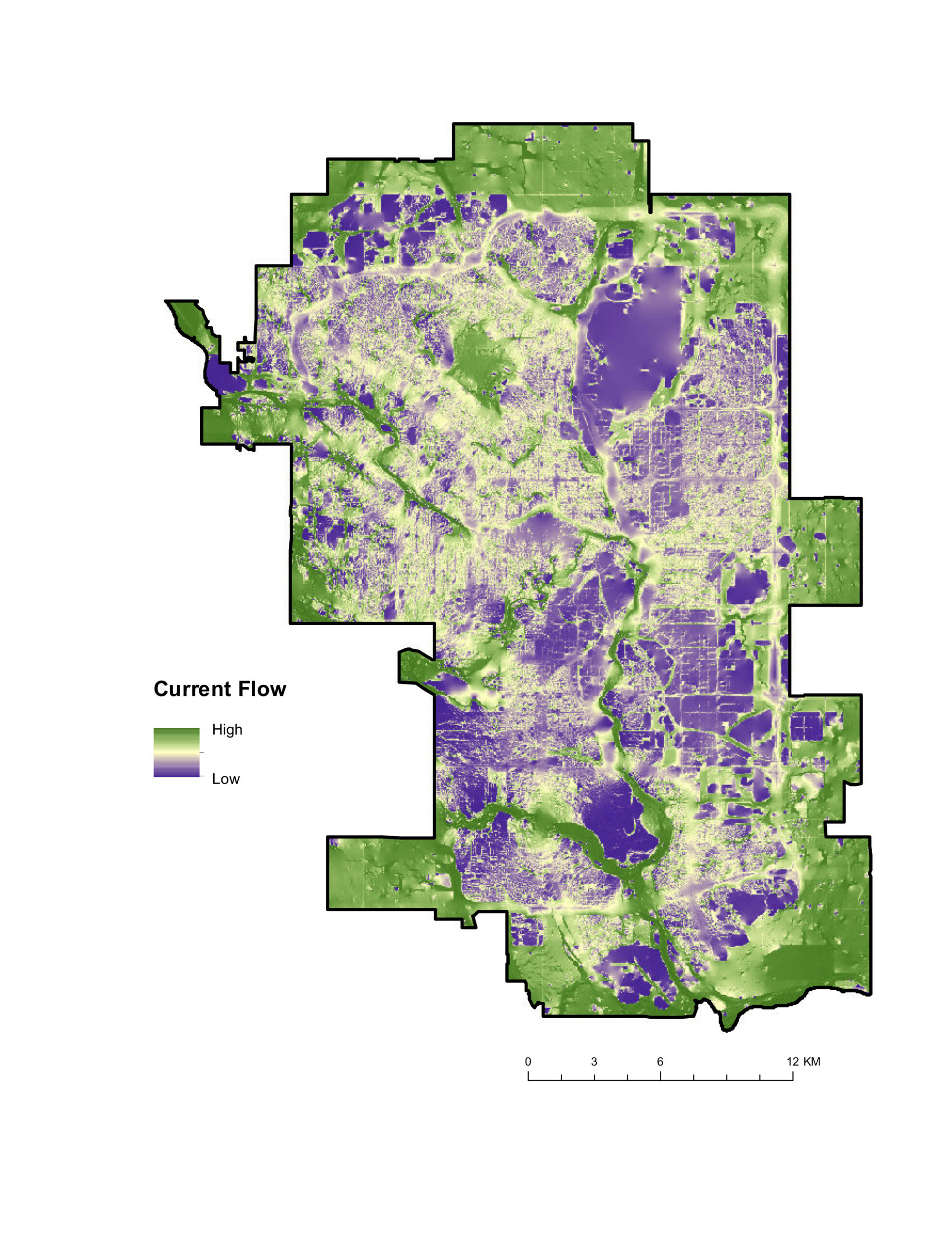
We developed a movement resistance surface that was based on measures of structural connectivity, as quantified primarily through land use and land cover data. Using a current flow model, the resistance surface was used to assess habitat connectivity, and the model was validated with empirical wildlife data.
The results of the validation indicated that the connectivity model reliably predicted areas of high functional connectivity, thereby identifying key areas of connectivity (major corridors), as well as potential pinch points or barriers to wildlife movement throughout the City.
This study provides The City of Calgary with valuable data that can be used to inform planning and management decisions—including prioritization of areas for habitat restoration and naturalization that will improve habitat connectivity both within and between Parks.