The North Saskatchewan Watershed Alliance (NSWA) and Battle River Watershed Alliance (BRWA) engage in many watershed assessment and management projects that require high-resolution spatial datasets.
While freely available and current land cover layers exist, the resolution of those data (typically 30 m pixel size) are not sufficient for analyses that require more detailed vegetation information. Thus, the NSWA and BRWA commissioned a medium-resolution land cover dataset that can be used to support on-going land use assessment and planning initiatives.
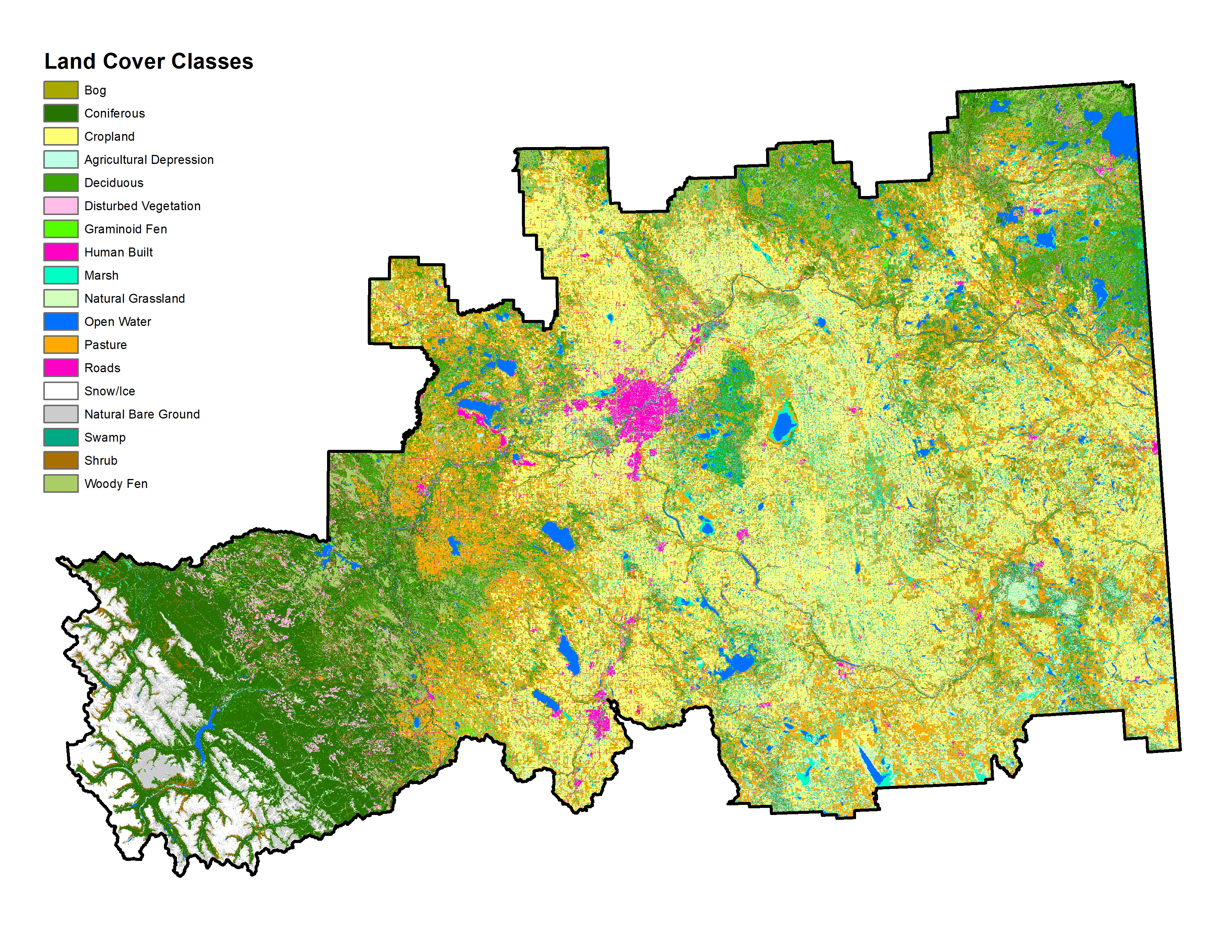
For this project, a 6 m pixel resolution land cover layer was created for the North Saskatchewan and Battle River watersheds, as well as a select number of intersecting municipalities, covering 111,429 km2, or approximately 17% of the province of Alberta. The land cover layer was created using SPOT 6 and SPOT 7 satellite imagery from 2017 and 2018. In order to create a product that could serve multiple land use planning purposes, we created a detailed, hierarchical land cover classification with 18 “Level 2” classes, that nested into 10 broader “Level 1” classes.
This land cover dataset will be used by the NSWA, BRWA, and many of their stakeholders to undertake a wide range of landscape-level planning initiatives that will improve watershed management outcomes across central Alberta.